OOTS: Garden Organic's Car Park
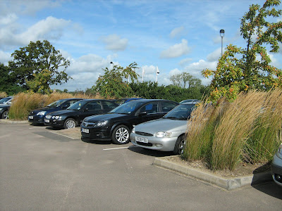
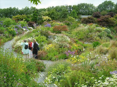
This time last year I visited Garden Organic's HQ at Ryton near Coventry to have a look around their varied demonstration gardens. Before I'd even made it that far, I was struck by the planting in the car park: here you can see tall, wavy grasses topped off by crab apples trees (do click for a larger image if required). This is very different to the usual car parks seen around Chippenham, but it seemed to me it would be great if this kind of planting was adopted more widely. There was an interpretation board nearby which gave lots more information about what had been planted: The planting in our car park has been designed to provide year-round interest for our visitors whilst providing food and cover for wildlife. Many of the shrubs and trees provide fruits, berries or hips, all of which are a magnet for birds. The tall stems of the ornamental grasses are left on over winter to provide cover for hibernating insects. Spring interest is provided by flowering shrubs such a...